Today’s weather engendered more enthusiasm in us.
Not that it was stunning, but rather that it was considerably better than the previous day. The improved weather combined with the revelation that we were not broken after yesterdays mission and that today’s walk was to be a gentler affair, we set off with a relative spring in the step.
The weather was more “Seasonal” with the promise of showers rather than non-stop drizzle, the chance of some sunshine in exchange for occasional rain seemed like a bargain worth accepting with glee.
We still had all the kit, just as precaution against wintry happenings.
 |
| Start of Bradford Dale |
Prepared for mud I stuck on the Gaiters. I always think I might look like and idiot with them on, and they do give me hot legs (well hotish feet – which is actually rather good in the cold weather), however the fiddles is worth it, as at a destination of they come and all the mud with it, revealing clean trousers beneath. I don’t think they would look good with shorts.
The decent into Alport was as ever, sharpish, but also short, and thus sweet. Alport is an entirely charming hamlet of a handful of properties, and has much charm crammed into a very small space. Buildings mostly of stone and of some age, with the insertion of Farrow and Ball woodwork where appropriate. Just over the bridge of the Lathkill river slightly upstream from its confluence with the Bradford river, we take a track of gravel. This was to be the surface for almost the whole journey, which made todays walk seem like a stroll after yesterdays challenging terrains and surfaces.
The track roughly follows the course of the river Bradford, occasionally parting to greet again around a corner. Limestone cliffs appear and dominate to our left, and recede into grassy slopes and dales, to then again triumph further on. Opposite minor limestone crags display their strata whilst sheep stand proud upon ledges like kings of the castle: presumably thinking us walkers the unwashed below. (Although probably not, sheep have never struck me as the intellectuals of the farm yard). The slope opposite mellows, and the southern fringes of Youlgreave in the form of the Hamlet of Bradford spill down the hillside, topped by a proud skyline of stone buildings, with the church sticking proudly into the air.
 |
| Crags with Sheep |
An ancient arched bridge of infinite charm leads up to Youlgreave, and is a quick route up to the couple of shops and trio of pubs.
We continued to follow the track, the river crystal clear, flowing and playing like and excited child. Weed in the river gaining fresh spring colour waving in the current with a life that plants on land cannot mimic.
Crossing a minor road we continue along a very pleasant track: the bridge seemed ancient, and not of arches, but low, squat on piers with slab deck. Parapets probably added later, and surface built up over centuries, who knows the history of this bridge. The valley broadens for a while into neat grass. Weirs start to control the river, taming the unruly child. A surprise seems to be a Lido of sorts, where there is an area for public swimming. It would be nice to find out more about this, not just for my curiosity, but also to save you, my friend and reader of my scribblings, the effort. Was it a gift, born or tragedy, an act of altruism, or just to keep folk out of all the other ponds and pools in the area? As, for the next several miles, just like the Lathkill river, there is weir and pond in very much constant succession. Now, I know that a one of these constructions on the Lathkill was for a mill, as the mill stones were still there, descended to the bare ground as the wooded fabric of the mill returned to nature. I imagine some were power sources for the industry of the area, the many mines that once abounded. However, on the Bradford the ponds are so regular and similar, I suspect some other purpose, maybe the farming of fish of yesteryear, before the trains allowed North Sea fish to be transported within hours from the ports, rather than the days it used to take, making the salting and smoking of fish an absolute necessity, or rancidity would take over.
 |
| Ancient Slab Bridge |
After this section with the swimming area, the outskirts of Youlgrave once more flirt with the river, and we cross on what looks like an ancient slab bridge: think of Tarr steps in Devon, piers with big slabs laid atop them. An ancient ford crosses the river, and the river bed looks like it might challenge all vehicles smaller than a tractor, although possibly a dream for an off roader.
The track now continues this side, and the track looks like it was old. Quite possibly and important route, like so many tracks in the peak district, in years past they were major routes for industry, pack horses, carts and agricultural uses like drovers sending the fruits of the farmers labour to their demise and the plate. The purpose of many of these tracts confined to the mists of history.
The river here is fully in the grip of the weir and pond one after another and it so this continues for the rest of the way. Big dams and weirs with placid pools behind, and furious flow over the spillway. Bird life abounds here. The usual suspects above, Blackbirds, Robins, Rooks, Pheasant, Crows, Buzzards, wood pigeons, tits and finches to name a few. However, the river has its own family, Wagtails flit and bob, and once again the entirely charming dippers bob and flap their way about. Mallard interspersed with Coot and occasional moor-hen, the wildfowl situation is very healthy here.
 |
| Coot in the River Bradford |
Walking along one notices that occasionally the river is topped up by water gushing out of the side of the valley. To call them springs seems to understate the flow: underground streams breaking for freedom of the dark confines to join the child like river.
The after a long gentle bend, and many repetitions of the weir and pond (one or two out of use, and the river reclaiming its rightful route again) the track turns and heads with certainty up to Middleton. This track has the certainty of purpose and breadth that suggests it was once a rather improtant route, but to me, the knowledge of this routs history is a closed book. A number of interesting structures here too, a mill, a sheepwash, both, I know not, but there is much to ponder.
 |
| Stone Books in a Drystone Wall |
Words on stone in a gap in the wall look like the bookshelf of a giant – as we walk we notice words etched in rock elsewhere.
Whilst the main track powers it way up to Middleton, we opted for the lesser track to the left, once again switching sides of the river. Ancient silted pond to our left, cliff to the right, once more on what looks like an ancient route, perhaps built for the pack horse. A small single slab bridge crosses a stream of extreme shortness, as only a few feet to the right (or a metre if you want to be scientific) it issues seemingly from a solid rock cliff with some considerable enthusiasm. There is a whole world of mysterious underground systems here, remnants of the ice age and milenia of the rain etching it way through the solid rock. The ancient dance of the Bradford and Lathkill stealing each others water through a monolith of billions of tones of limestone just to meet a few miles further on.
The track continues and we cross the river again. The bridge much more modern: it looks like a concrete lintel of some magnitude, only the width of a pair of feet, and with a single wood handrail to assist with avoiding the water. The path narrows, we are on the remaining stone edges of ancient track. Up some stone steps and suddenly up a galvanised staircase to get to the field above. The water now a little way down below has really been downgraded from river to stream.
We descend, cross again, and for the last time, and then traverse a very small crag. Very small.
 |
| Country Lane |
The next mile is a wander across lush meadow and pleasant countryside. A few little gates to negotiate, a few of the specialised peak district stone styles (climb over the wall) and eventually got deposited in a narrow country lane. The path continued opposite and I had considered taking it, but it was getting close to lunchtime, we hadn’t planned on a mission, and I suspected my wife might have become, quite rightly, a bit agitated if we had continued. Looking at the map after, it might have led to an easier ascent, but I had yorkshire pudding in my mind.
The lane was one of my favourites rural lanes – one with a lawn down the centre. It has at some point been fully tarmacadamed, but being so narrow, the centre of the road is totally un-molested apart from vehicle sumps, horses and walkers which stop it from becoming a wilderness.
We carried on up this lane, and for a while it was generous with the slope: it was the hill that kept giving!
 |
| Farm Sign |
Eventually, we joined a slightly less minor road that proudly announced “Middleton by Youlgreave”. It is a place out of a of history. We were blessed with nearly no traffic, there were few vehicles parked, and so we strolled with ease through the village. Ancient farms greeted us, and as we wound through this Hamlet we passed a little church and many ancient buildings. The centre of this settlement was a junction of roads bereft of trafic and realy rather large – so little traffic and so much space there was no need for any road markings. A complete lack of White, yellow, or any other coloured lines! We continued towards Youlgreave, and was rewarded with more bucolic views, old and ancient dwellings, a smart chapel that seemed to have become a residence, a grand view down a dale. The road easy and with pavement we continued, eventually joining the more road into Youlgreave that seemed to bear occasional bursts of traffic. We suspected that in the summer and the bank holidays surrounding summer that the situation might be different, but while we were there it was quite peaceful. Only the occasional hardy tourists, like ourselves, out on walking holidays and leaving small impact other then aiding the coffers of the local pubs, shops and farms with accommodation.
We sauntered into the village, ironically hampered by a tractor that was having issues with it being “Bin Day” in the village, and the refuse lorry plying its trade. The road not being much wider than the municipal vehicle.
There was a cake shop that warranted investigation, but we were after more solid fare, so headed to the George Inn. Here good and solid fare was ordered and received, served with speed and a warm greeting. I had been here before, and whilst the range of beer mas small, it was of an intensely agreeable quality. We left feeling refreshed and satisfied.
We had plans to revisit the village shop, but it seems that Wednesday was half day, and we approached the shop on the wrong half of the day. A pity as not an hour previous we had passed by it when open intending to revisit. I would highly recommend a visit. Currently it is not on google maps, but should be after I have written this, because I intend to add it!
 |
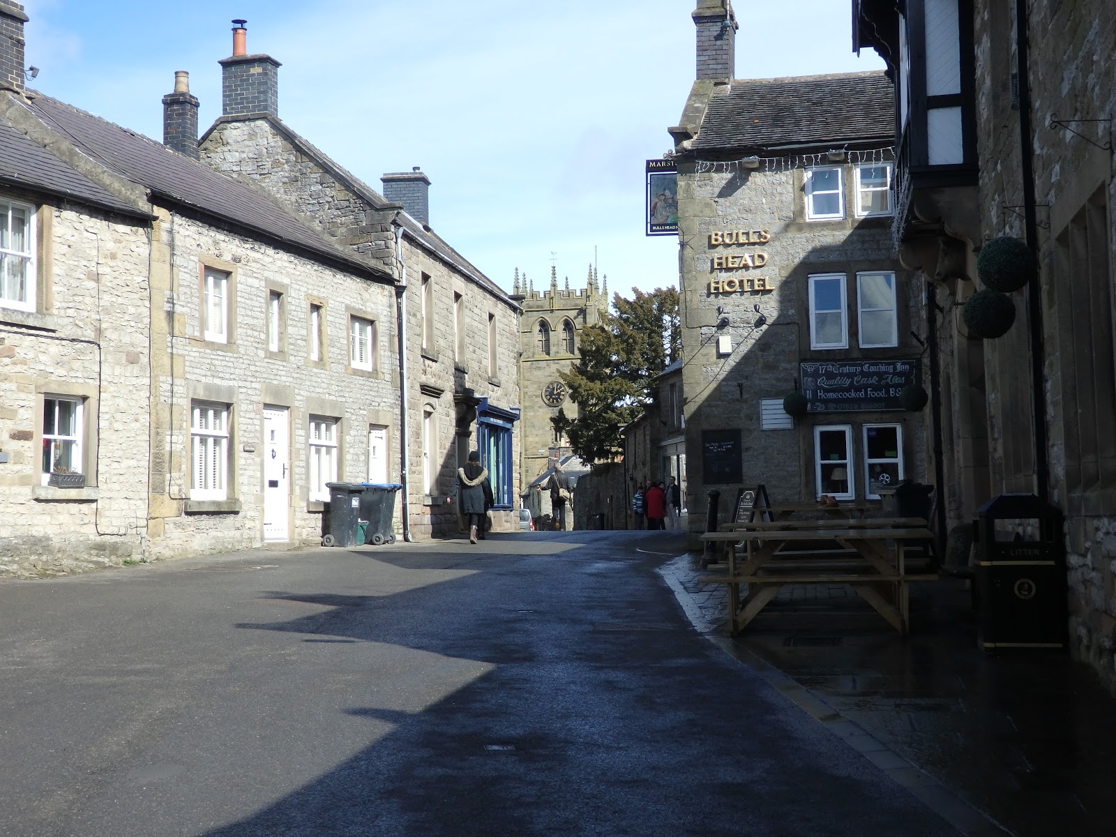
| Youlgreave, pub and church |
Bearing the disappointment of the shop closure for the afternoon reasonable well, we photographed the church and a few other historical features, and headed off down the road next to the church down to the river. We rejoined the track next to the river, and made our way back to Alport and home to our temporary resting place.


